Academic Task 1 Map - 1st
Question
The two maps below show the changes that have taken place in the coastal village of Seaview between 2005 and 2025. Summarise the information by selecting and reporting the main features, and make comparisons where relevant. Write at least 150 words.
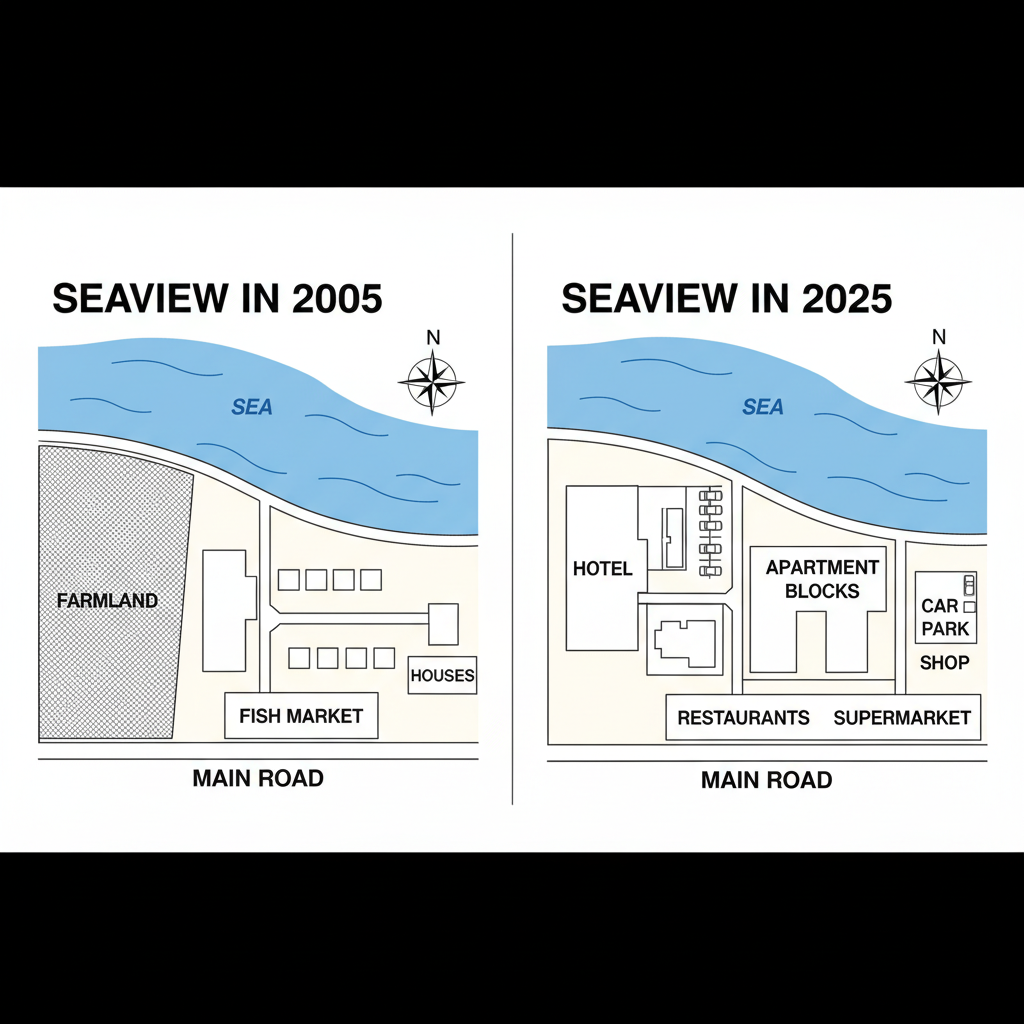
The two maps illustrate the significant developments that occurred in the coastal village of Seaview over a 20-year period, from 2005 to 2025. Overall, the village underwent a major transformation from a traditional fishing community into a more modern residential and tourist-focused town.
In the northern part of the village, the most substantial alteration was the redevelopment of the farmland. By 2025, this large agricultural area had been completely replaced by a new complex of apartments. In contrast, the school and the row of houses situated to its east, both north of the main road, remained unchanged during this period.
The southern, coastal area of Seaview experienced even more dramatic changes. The infrastructure related to the fishing industry was entirely removed; the harbour was demolished, and the fish market was replaced by several new restaurants. The original cafe next to the fish market was also torn down. Furthermore, the residential houses along the seafront were demolished to make way for a large car park, which is now connected to the main road by a new roundabout. While the hotel remained, a final notable addition was the installation of wind turbines in the sea to the west of the village.